Reliable subsurface information for safer engineering decisions.
Integrated geotechnical, geological and geophysical investigations for infrastructure, energy, groundwater, environmental and heritage projects across Egypt and the region.
8
Capability areas under one team
8
Industries served
100 m
Downhole seismic testing depth*
ASTM · ISO · BS
Referenced standards
01 — ABOUT US
From subsurface data to practical engineering information.
Geo-Consultants Group combines advanced investigation techniques with professional interpretation to deliver reliable subsurface information for design, construction, site characterization and resource assessment.
We integrate geophysical observations with geological, borehole and geotechnical data wherever available — giving clients a clearer picture of ground conditions and reducing engineering uncertainty.
Vision
A leading geotechnical and engineering geophysics consultancy in Egypt and the region.
Mission
High-quality, cost-effective investigations that support safe, sustainable project development.
02 — TECHNICAL CAPABILITIES
One team. Every method the ground calls for.
01
Seismic Investigations
MASW, seismic refraction & SRT, downhole and crosshole testing for Vs/Vp profiles and site classification.
02
Electrical Resistivity Investigations
2D/3D ERT, vertical electrical sounding and soil resistivity (earthing) testing.
03
Electromagnetic Investigations
Terrain conductivity, MT, VLF, TDEM, utility detection and ground-penetrating radar.
04
Gravity & Magnetic Investigations
Gravity, micro-gravity and magnetic surveys for structures, voids and basement depth.
05
Thermal Property Investigations
Soil thermal conductivity and rock thermal characterization for energy and geothermal projects.
06
Geological Mapping
Geological and structural mapping of units, contacts, faults, fractures and lineaments.
07
Geotechnical Investigation & Testing
Boreholes, soil & rock characterization, compaction, plate load, bearing capacity and settlement.
08
Integrated Interpretation & Modelling
Geophysical–geotechnical integration, engineering interpretation and 2D/3D ground models.
03 — OUR APPROACH
A clear six-step workflow, quality-controlled at every stage.
01
Plan
Define engineering objectives and select appropriate investigation methods.
02
Investigate
Acquire high-quality geophysical and geotechnical data to project requirements.
03
Process
Apply appropriate processing, quality control and data validation.
04
Integrate
Combine geophysical, geological, borehole and geotechnical information.
05
Interpret
Develop engineering-focused subsurface models and characterize risks.
06
Deliver
Clear technical reports, maps, sections, models and actionable conclusions.
04 — INDUSTRIES
Where our work supports projects.
Buildings & Foundations
Foundation investigations, subsurface characterization, stiffness, bedrock depth, weak zones, bearing capacity and settlement.
Roads, Highways & Bridges
Subgrade characterization, geological profiling, weathered/bedrock mapping and weak-zone assessment.
Airports & Major Infrastructure
Engineering site characterization, seismic investigations and dynamic ground-property assessment.
Renewable Energy & Power
Solar PV and energy infrastructure site characterization, foundation investigations and thermal-property assessment.
Groundwater & Hydrogeology
Groundwater exploration, aquifer investigation, lithological characterization, fault and fracture identification.
Environmental Investigations
Non-invasive subsurface screening, anomalous-zone investigation and environmental site characterization.
Tunnels & Underground Structures
Bedrock and geological structure mapping, weak-zone identification and seismic characterization.
Heritage & Restoration
Non-invasive investigation supporting restoration and subsoil assessment around sensitive structures.
05 — SELECTED PROJECTS
Recent work across Egypt.
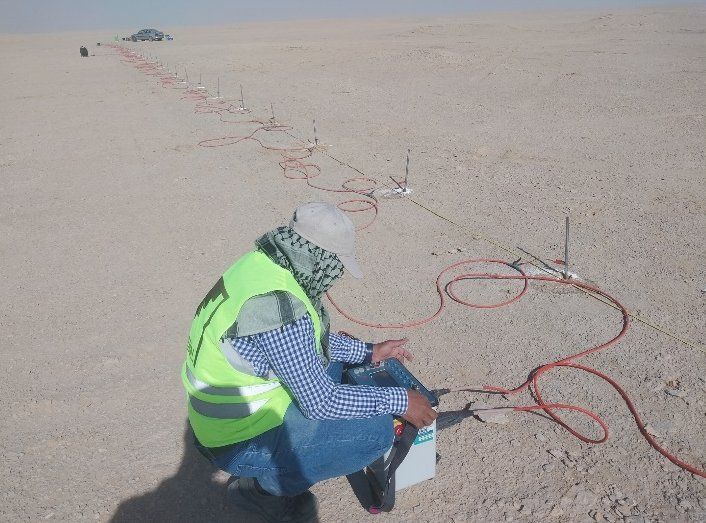
Energy Valley PV — El Minya
El Minya, Egypt
Integrated geophysical investigation and engineering subsurface characterization for the solar PV plant site.
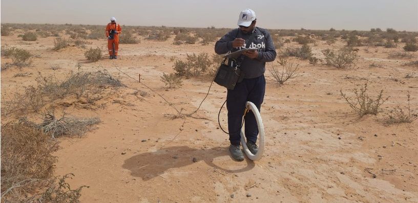
Wadi Yemm — Ras El Hekma
Ras El Hekma, Egypt
Engineering geophysical investigation supporting subsurface characterization and project development.
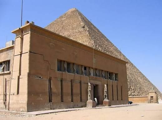
King Farouk Rest House — Giza Pyramids Plateau
Giza, Egypt
Engineering geophysical investigation supporting restoration works, subsoil improvement and surrounding-area development.
06 — WHY GEO-CONSULTANTS GROUP
Built to reduce engineering uncertainty.
Integrated expertise
Geotechnical, geological and geophysical capabilities within one investigation framework.
Engineering-focused solutions
Investigation programs designed to directly support engineering decisions.
Right method, every site
Techniques selected by project objectives, ground conditions, required depth and scale.
Reliable interpretation
Integration of multiple datasets improves subsurface understanding and reduces uncertainty.
Professional reporting
Clear, structured deliverables for engineers, consultants, contractors and project owners.
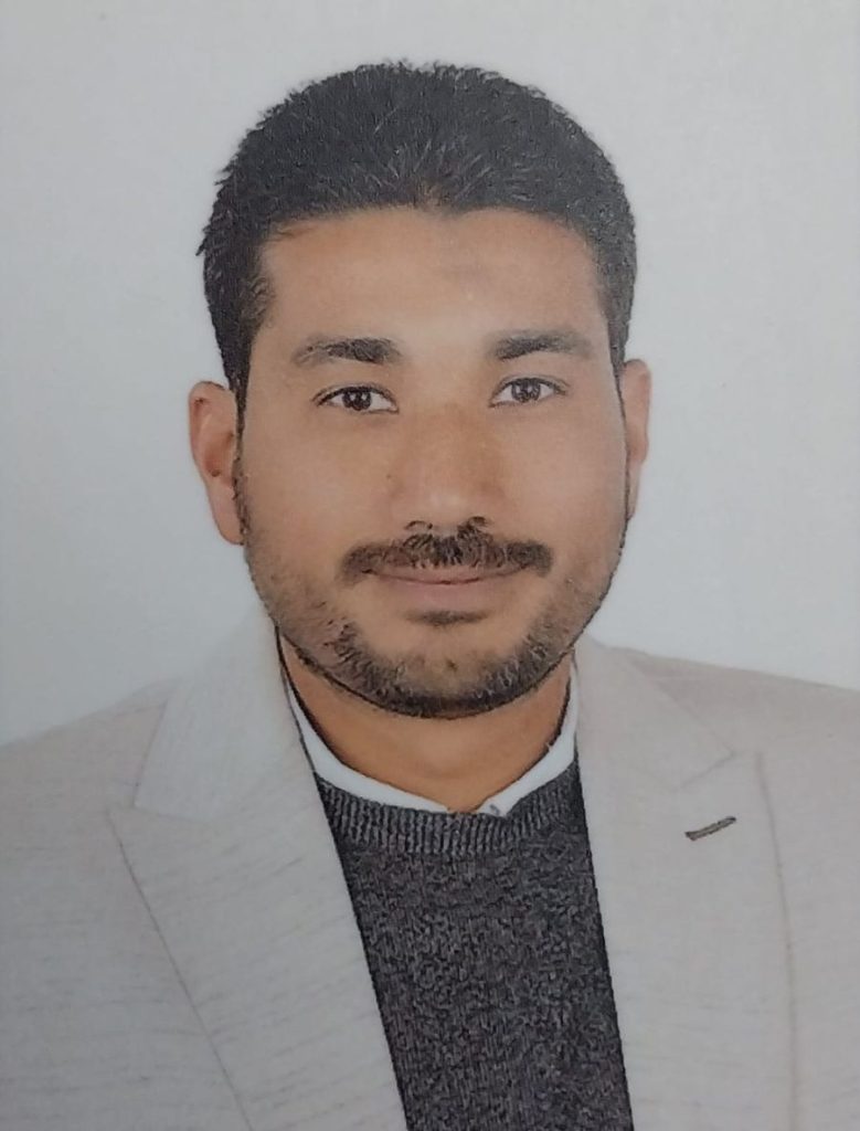
LEADERSHIP
Dr. Mohamed Ibrahim Mohamed
General Manager · Senior Engineering Geoscientist
Researcher in Engineering & Applied Geophysics, Geomagnetic Laboratory, Geomagnetic and Geoelectric Department, National Research Institute of Astronomy and Geophysics (NRIAG).
Consultant Registration No. 2024/3/00023
Planning a project? Let's understand the ground first.
Tell us about your site and objectives — we'll recommend the right investigation program.